July 16, 2023 |
View Online | Sign Up |

Thousands of Teacher-reviewed Resources!
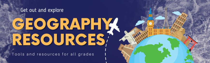
Explore Geography Resources
In recognition of the founding of the first U.S. postal system with Benjamin Franklin as the postmaster general on July 26, 1775, and the introduction of the zip code in 1963, we are sharing resources related to geography awareness. We have included resources for all grades, from maps to geography games to virtual field trips.
Grades K-7
National Geographic Kids
Discover information about animals, geography, and the natural world presented in a fun and engaging format. This resource includes engaging short videos, images, stories, polls, news bites, games, activities, and more.
Grades 6-12
American Panorama
American Panorama shares interactive maps demonstrating changes in the United States since the 1800s. Current maps include information on the forced migration of enslaved people, the overland trails, canals, foreign-born populations, and other topics.
Grades K-12
Virtual Field Trips
Visiting cities and famous landmarks may be outside your school's budget, but the next best thing is taking students to visit locations online. Take your students worldwide with this curated list of resources offering free virtual field trips.
Grades 6-12
Google Arts and Culture
Visit over 2,000 museums without leaving home through the lens of Google Arts & Culture's presentations. Explore the studios of famous artists, take tours of historical cities through virtual trips, and learn about cultures from around the world.
Grades 4-12
Where on Google Earth is Carmen Sandiego? The Tutankhamun's Mask Caper
Help Carmen Sandiego track villains across the globe to recover some of the world's stolen treasures. Follow the prompts to investigate the crime scene and track the criminal members of Vile. Use the magnifying glasses to interview the suspects.
Grades 7-12
Mapping the Nation
Mapping the Nation is the companion site to the book of the same title. It provides images and context surrounding the rise of different mapmaking methods in the 19th century. Each item includes extensive information, a creation date, and a map type.
Grades 6-12
The Globe of Extremes
Use this interactive globe to learn about some of the most extreme locations on Earth. Find the highest mountain, discover the most distant point from land, and more by turning the globe and clicking highlighted areas to learn additional information.
Grades 6-12
Native Land Digital
View this interactive map of indigenous territories around the world. Click an area on the map or type in an address to find relevant tribes from that area. Each tribe name includes a link to a page that tells more about the tribe or treaties referenced.
Grades 4-12
City Guesser
Play City Guesser as an individual or in a multiplayer scenario to see how well you know your geography. Select from the different world areas, or try your hand anywhere in the world as your starting point. Drop a pin when you think you know where it is.
Grades K-12
Africa in the K-16 Classroom Online Resources
Follow the links to access featured resources, podcasts, teaching tips, and more. There’s also an extensive library for educators divided into grade-level categories. Each includes resources related to pedagogy, children's literature and more.
Grades 6-12
Geo-fs Flight Simulator
Geo-fs.com is a free online flight simulator with an open-source platform that renders global landscapes you can fly over. The site will work on any modern web browser, including Chrome! Control your plane with a keyboard, mouse, or joystick.
Grades K-6
Geography Games
Try these geography games that test your knowledge of countries, flags, and other locations or landmarks. Choose any of the games to view the directions and begin playing. Students can use this for practice before geography quizzes.
This Week at TeachersFirst
Join us for three professional learning opportunities this week. On Tuesday and Wednesday, we continue our FREE summer OK2Ask workshops, and on Thursday we have our bimonthly Twitter chat. We are also sharing a related blog post and kindly ask for your input on our weekly poll.
 |
Tuesday, 7/18, 6 PM ETOK2Ask: Winning Ways to Use Google Forms in the ClassroomRobust, simple, and loaded with options, Google Forms can be used to create exit tickets, surveys, quizzes, and rubrics, as well as to collect data and communicate with students and parents. Join us to plan for the use of Google Forms in the classroom. |
 |
Wednesday, 7/19, 6 PM ETOK2Ask: Engage & Inspire with More EduprotocolsEduprotocols are a set of structured lesson designs that enable teachers to deliver content and engage students in interactive learning experiences. This second session in our series will review Eduprotocols and how they can be used in different subjects. Understand the purpose and benefits of using Eduprotocols in the classroom » |
 |
Thursday, 7/20, 8 PM ETTwitter Chat: Digital ReadingCome and tweet with us using the hashtags #OK2Ask and #TeachersFirst. During this chat, participants will discuss strategies for maximizing available classroom technology and share tips for integrating digital reading experiences in the classroom. Explore ways to use tech tools for digital reading experiences » |
 |
Infusing Technology BlogDigital Storytelling Using Google My MapsSkim this blog post highlighting how to integrate geography and digital storytelling into your classroom. Incorporating maps into digital storytelling projects allows students to use visuals as part of the storytelling process. Learn ways to incorporate maps into the storytelling process » |
 |
Share your thoughts with our communityWeekly PollThis week our poll asks, "What kind of geography tech tools are you most likely to use with your students?" Share your choice and view the responses of other educators once you click submit. |
Brought to You by TeachersFirst
Connect with us
Twitter | Facebook
Editorial
Contact the editor
About TeachersFirst
TeachersFirst is a collection of curated, classroom-ready content and ideas — including teacher-authored reviews of thousands of web resources. Built-in guidance from seasoned professionals makes effective classroom technology use trouble-free. TeachersFirst is made available free to K12 teachers by The Source for Learning, Inc., a nonprofit that has been providing educational resources for more than 40 years.